|
E. Linacre |
9/'99 |
![]()
Conditions averaged over the 73 five-day periods of twelve El Niño years have been calculated for various places of the USA, identifying areas warmer/cooler and wetter/drier than usual at each time of the year (1). The same was done for these La Niña years. Such an analysis showed the times of onset of unusual conditions across the country during an El Niño.
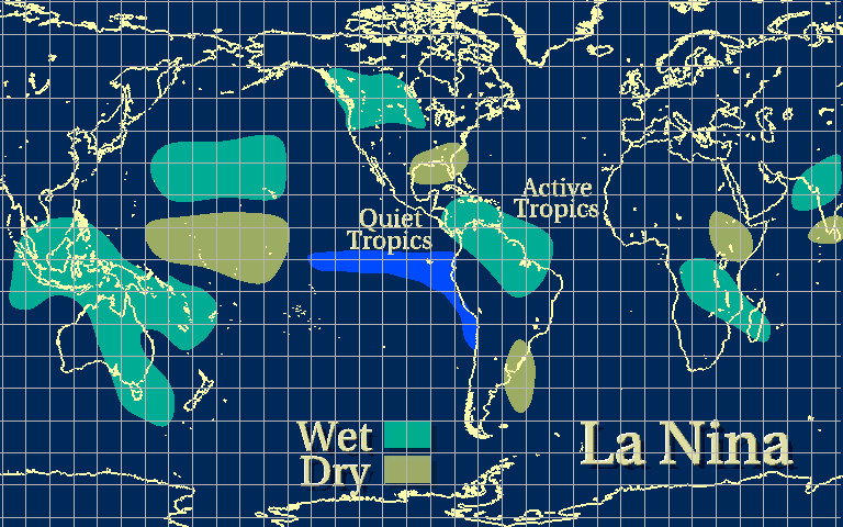
In general, an El Niño leads to more winter precipitation in California and the South (Fig 1), and less in the summer rain in Mexico (2). A La Niña usually implies more winter rain in the Pacific Northwest. In an El Niño year temperatures tend to be high in northern US and the Canada Plains from November to March, while in a La Niña period the central and southern parts of the US tend to be warmer than normal (1). These patterns verified in the 1997-98 El Niño.
|
USA |
EL NINO |
LA NINA |
|
precipitation |
|
|
|
temperature |
|
|
Fig 1. Temperature and precipitation anomalies in the USA in an El Niño and in a La Niña (source: Climate Diagnostics Center).
References
(1) Palecki, M.A. 1999. Examining the climate response to El Niño and La Niña using high temporal resolution approaches. Preprints to the 11th Conf. on Appl. Climatol., Dallas, Texas (Amer. Meteor. Soc.), 97-100.
(2) Conde, C., V. Magana & R.M. Ferrer 1999. On the use of a climate forecast in the planning of agricultural activities in the state of Tlaxcala, Mexico. Preprints to the 11th Conf. on Appl. Climatol., Dallas, Texas (Amer. Meteor. Soc.), 101- 2.


