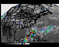
Asks students to apply their knowledge to interpret
what they see in a variety of satellite images, including a series
recorded one day in February on the West Coast of the U.S.
To begin the lab exercise immediately, click on the "START" button. For
further information, read on.
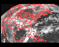
In this exercise, you apply basic concepts about solar and
terrestrial radiation, plus common-sense knowledge about basic physical
properties of clouds and of land and ocean surfaces, to interpret
visible and infrared satellite images. It assumes that you have
already been introduced generally to weather satellites and weather
satellite images, and in more detail to basic concepts about solar and
terrestrial radiation and the basic laws of radiation. Therefore, you should be
familiar with Chapter 2 of the textbook "Meteorology Today", 6th
Edition, by D.C. Ahrens.
Background reading
The following background information is needed to prepare you to do this lab:
You can start the exercise at any time by clicking on the "START" button.
Please note that when you start the lab exercise, a new browser window
will open without the familiar browser menu bars. You can always return
to this page by selecting the "Exit" button.
Address questions and comments to Bart
Geerts.
Acknowledgements: this lab was developed by Dr. Dave Dempsey,
Dept. of Geosciences, San Francisco State
University